The remains of one of the few brochs in southern Scotland can still be seen about 2 miles NW of Galashiels commanding extensive views over the Gala Water and south east to the Eildon Hills. Excavations in 1891 and 1950 suggest the Broch was built on the site of an earlier Iron Age fort sometime in the 1st or 2nd century AD and then destroyed pretty soon after, possibly on Roman military order.
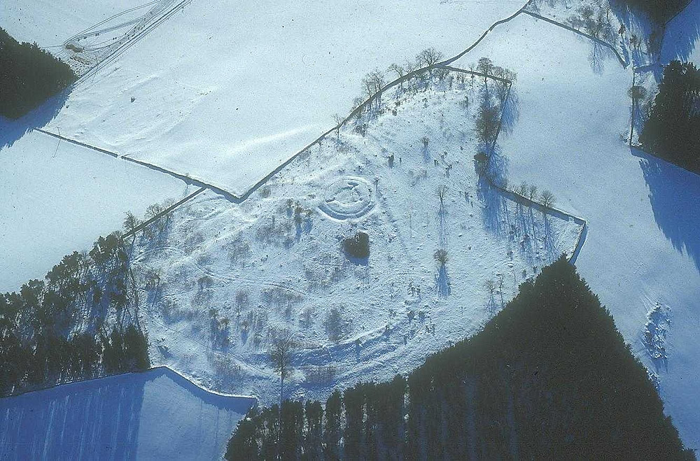
It has been mutilated and robbed of stones over the centuries, probably to build dykes as field margins. There are also signs of Celtic lynchets or terraces in the fields below facing south and east (running to the top left of the photo) which are assumed to be contemporaneous with both the fort and the Broch.
More information can be gleaned from the Proceedings of the Society of Antiquaries of Scotland and don't forget the Catrail which passes through the Estate and is very visible around the broch area.